
3D Scanning LiDAR Technology
As 3D scanning specialists, we offer a service designed to capture reality with millimetric precision and transform it into useful information for every stage of a project. Our work combines state-of-the-art LiDAR technology with a rigorous technical approach, allowing us to document spaces, structures and construction elements with a level of detail impossible to achieve using traditional methods. This capability enables us to reduce uncertainty, anticipate problems and optimize decision-making from day one. Our team supports each client throughout the entire process, from scan planning to final data delivery, ensuring that the information obtained is clear, accessible and fully adapted to project requirements. Whether for architecture, engineering, industry or heritage, 3D scanning has become an essential tool for working safely, efficiently and reliably. Our goal is for every client to rely on solid, accurate and up-to-date data, transforming the complexity of the real environment into ready-to-use digital information.
Capabilities
What is 3D scanning and what is it used for?
3D scanning is a technology that captures the shape, dimensions and details of a physical space with great precision, transforming it into a three-dimensional digital model. Using high-precision LiDAR scanners, millions of points are obtained that faithfully recreate reality, generating what is known as a point cloud. In architecture, construction and interior design, 3D scanning is used to obtain accurate measurements of existing spaces, create plans, BIM models or realistic virtual recreations, support renovations, refurbishments and changes of use, detect errors or clashes before construction, document the current state of a property with complete reliability, verify whether the built work matches the project drawings and document and preserve architectural heritage. Thanks to 3D scanning, the margin of error is reduced, time is saved and better-informed decisions can be made from the beginning of the project.
3D Scanning for Architecture
We work with architecture, engineering and interior design studios to provide an accurate digital base of the current condition of any building or space. Our 3D scanning allows renovation, refurbishment or extension projects to begin with reliable data, avoiding errors caused by manual measurements and reducing uncertainty during the design phase.
Point Clouds and BIM/CAD Modeling
The point cloud is the direct result of 3D scanning: a massive set of millions of points that accurately represent the geometry of the real space. From this information, we generate BIM models or CAD drawings that translate reality into precise technical documentation. Our process ensures that each model is useful, organized and adapted to the needs of the project.
As-Built Drawings
As-Built drawings document how a building is actually constructed, including variations, deviations and modifications that do not appear in the original drawings. Based on 3D scanning, we produce detailed and verified As-Built drawings or models, ideal for renovations, legalizations, certifications, maintenance or asset management. This process eliminates uncertainty and provides a solid documentary base for any future intervention.
3D Scanning for Industry
In the industrial sector, 3D scanning is a key tool for documenting complex facilities, verifying clashes, planning extensions and controlling maintenance processes. We work with industrial plants, factories and technical environments where precision is critical. Our service provides accurate digital information that helps reduce errors, improve safety and optimize decision-making.
3D Modeling
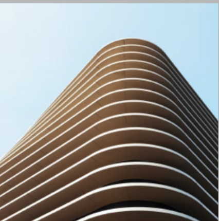
3D modeling consists of transforming the point cloud into an accurate and structured digital representation of the real space. We create BIM models at different levels of detail according to the needs of the project, maintaining a balance between detail, efficiency and final use. This modeling allows teams to work with reliable information for design, coordination, maintenance or facility management.
Frequently Asked Questions
3D Scanning with LiDAR Technology
What is LiDAR technology?
LiDAR technology is a laser-based measurement system that captures millions of points per second to accurately represent the geometry of a space or object. It works by emitting pulses of light that bounce off surfaces and return to the sensor, calculating distances with millimetric accuracy. This technology is ideal for architecture, engineering, industry and heritage because it provides reliable data even in low-light conditions or complex geometries. Its main advantage is the speed and precision with which it documents real environments, creating a solid basis for any technical project.
What is the difference between LiDAR and photogrammetry?
The main difference between LiDAR and photogrammetry lies in the precision and definition of the result. LiDAR technology, especially with professional scanners such as FARO or Leica, provides extremely precise, stable capture with high point density even at long distances. Its performance does not depend on lighting or texture, which guarantees clean and reliable point clouds in any environment. Photogrammetry, on the other hand, generates models from photographs and usually has lower resolution, more noise and lower geometric accuracy, especially indoors or on smooth surfaces. It is useful for large outdoor areas, but does not reach the quality or consistency of LiDAR in demanding technical projects.
What format is LiDAR point cloud data delivered in?
Point clouds can be delivered in standard formats such as E57 or RCP/RCS, compatible with most BIM, CAD and visualization software. We also offer optimized versions to make them easier to use on computers with lower processing capacity. Before delivery, we clean and organize the point cloud to ensure that the file is easy to handle and integrates smoothly into the client’s workflow. We adapt the format according to the needs of the project and the software used by each team.
For what type of projects is as-built 3D scanning recommended?
As-built 3D scanning is ideal for renovations, refurbishments, extensions, legalizations, site control and any project that requires an exact understanding of the real condition of a building. It is also essential in heritage conservation and restoration, as it allows complex geometries, historical elements and irregular surfaces to be documented without physical contact. The resulting data provides a reliable base for decision-making, design and future interventions.
How long does a 3D scan take?
The time depends on the size and complexity of the space, but in most cases the scan can be completed in two or three days. Our team plans the capture to minimize interruptions and ensure complete coverage. After scanning, we carry out data processing, alignment and point cloud cleaning, which may take from a few days to a week depending on the volume of information. We always provide a clear estimate before starting so the client can organize the project without uncertainty.
What advantages does 3D scanning have on site?
3D scanning allows progress to be verified, deviations to be detected, installations to be controlled and the real state to be compared with the projected model. This reduces errors, avoids rework and improves coordination between teams. It also documents each stage of the work with precision, creating a reliable record for certifications, audits or future maintenance. Its speed and accuracy make it a key tool for complex projects or tight deadlines.
How does 3D scanning work in refurbishments and renovations?
In refurbishments, 3D scanning provides an accurate base of the current condition, including deformations, irregularities and hidden elements that are difficult to measure manually. This allows designs to be developed safely and problems to be anticipated before they appear on site. Our team captures the space without dismantling elements or interrupting activities, and delivers a point cloud or BIM model ready for work. The result is a more efficient design process, with less uncertainty and greater technical control.
Is 3D scanning suitable for existing buildings and heritage?
Yes, 3D scanning is especially useful in existing buildings and heritage, where precision and detailed documentation are essential. It records complex geometries, historical elements and irregular surfaces without physical contact, preserving the integrity of the asset. The data obtained is used for restoration, conservation, maintenance and technical analysis, allowing interventions to be planned with greater safety and accuracy.